Monday, June 27, 2011

Weekly Summary: June 20-26

This week I started to taper for the upcoming Finger Lakes 50s, so only four days of running, but I did get in a nice race at Forge the Gorgeous and a longish trail run on the Finger Lakes Trail.

Mon: rest

Tues: Beaudry Park hills and high school trails (1 hr)
Urban trail run consisting of one hill set at Beaudry Park, some meandering on the trails by the Cortland high school, and another hill set.

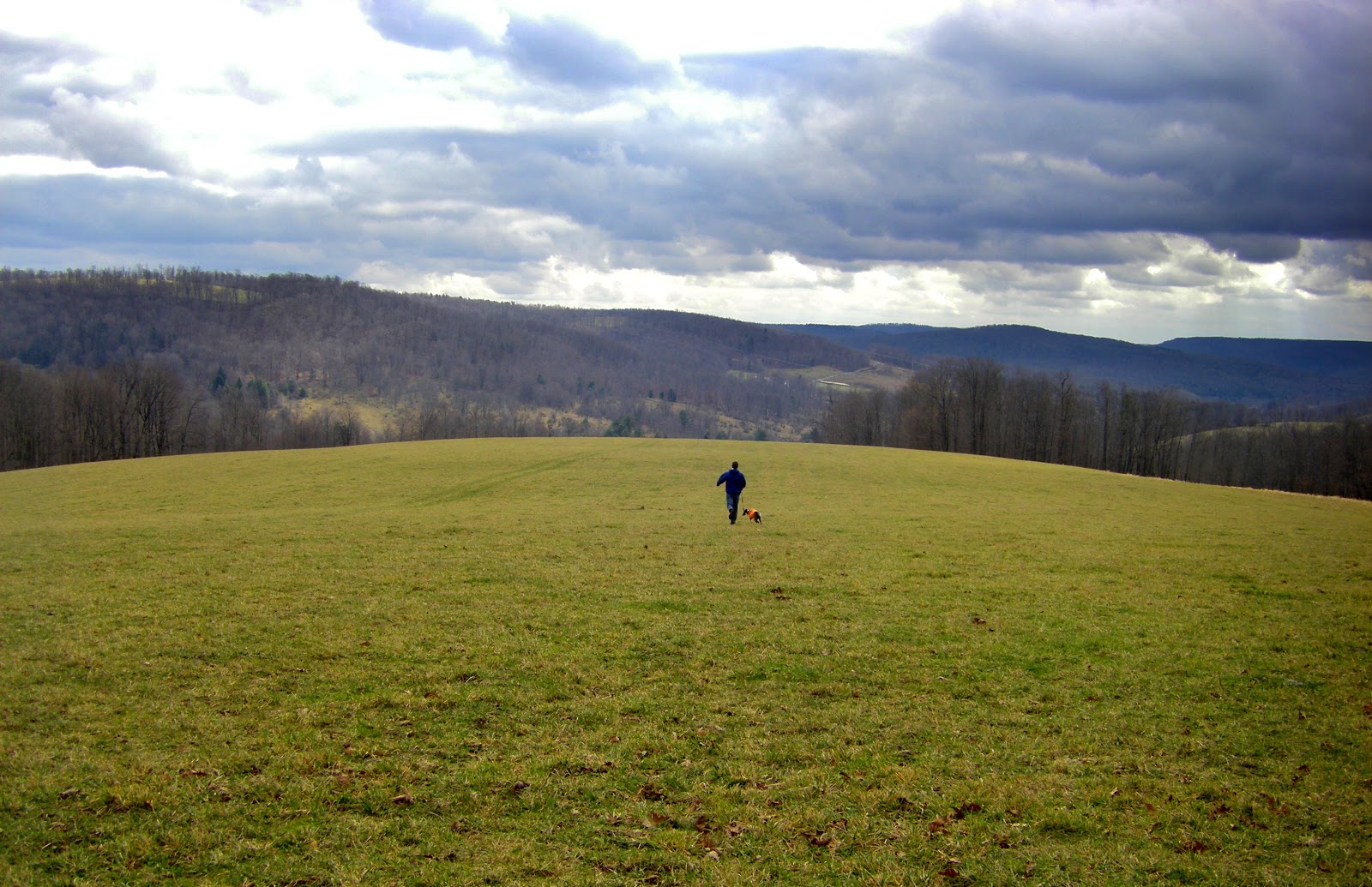
Wed: Blue Creek loop (6 mi)
This is one of my standard road runs in Cortland. It gets out of the city fairly quickly and features a couple small hills and pleasant views.

Blue Creek loop

Thurs: Forge the Gorgeous (7 mi, 55:31, 8th/108)
This was a fast, fun, and scenic local race with a good amount of climbing. Check out my race report.

Fri: rest

Saturday: Trail run in Kennedy S.F. (14 mi, ~2:30)
The Finger Lakes Trail in Kennedy State Forest south of Cortland keeps sprouting loop trails, creating many interesting options for running routes, and I utilized three of them on this run: the well established Dabe's Diversion Loop and the newly constructed Swedish and Lithuanian Loops. Check the bottom of this page from cnyhiking.com for a nice map of these trails. 

Parking at the intersection of Hauck Hill Rd. and Bleck Rd., I headed south on the Dabe's Diversion Loop to the rockpile, where the extreme humidity made for a hazy view, and then turned west on the FLT. Now that it's mid-summer, the foliage is incredibly dense in some places, and coupled with thick cloud cover this made for twilight-like light levels during the middle of the day. I found myself slowing down at times due to the low light.

About halfway down the hill to Babcock Hollow Rd., the Lithuanian Loop trail splits off to the right, descending to the road a little bit north of where it intersects the main FLT, then traversing back uphill to meet the FLT again only 0.1 mile below where it first split off. It makes for an interesting little 1 mile diversion, including a section that weaves through a dense, uniformly spaced pine plantation with a smooth bed of pine needles.

After rejoining the FLT and running in and out of Babcock Hollow and over the next ridge, I took a right on the Swedish Loop, which climbs 0.5 mi on Bell-Hilsinger Rd. and then begins the descent to Daisy Hollow, rejoining the FLT half way down. This was a great section of singletrack trail, well cleared and passing through some nice forest (it also bypasses the climb up Owego Hill- a good or bad thing depending on your perspective).

Once back on the FLT, I ran down to Daisy Hollow, then turned around and followed the white blazes all the way back to the rockpile, then up the Dabe's Diversion Loop to my car. I got rained on a bit and ended with soaked feet as usual, despite the best efforts of my new Drymax sock ("#1 sock to keep feet dry"). So ended my last long trail run before the Finger Lakes 50s. I took it relatively easy, felt very good, and enjoyed both the new and familiar trails.

I also have some ideas for a Kennedy State Forest mega-route, incorporating the entire FLT from Daisy Hollow to Tone Road plus the Irvin, Spanish, Swedish, Lithuanian, Dabe's Diversion, and Virgil Mountain Loops. Looking forward to that!

Friday, June 24, 2011

Forge the Gorgeous race report

I decided semi-last minute to run this race, even though its distance (7 mi) is a little short for my liking.  I had three main reasons: 1) after months of training I just wanted to run an actual race; 2) the trails are indeed gorgeous; 3) pizza at the finish line.

The race is held in Fillmore Glen State Park in Moravia, and the course consists of two partially overlapping loops, basically ascending and descending the glen twice: up the North Rim Trail, down the South Rim Trail, up the Gorge Trail, and back down the North Rim Trail.

Map of Forge the Gorgeous course with first loop in red and second loop in orange. Not sure this is 100% accurate, but it gives the basic idea.

I tend to start races slowly, but my tentative plan was to go out hard and see how long I could stay with the big guns. The race began with a sprint of several hundred yards up a grass field before crossing a bridge over the creek and starting a steep, switch-backing ascent up the North Rim Trail. At the beginning of the climb I was close to the leaders, but it was quickly apparent that I would kill myself trying to hang with them. So I found a steady pace, gradually passing a few people on the first half of the ascent.

Once the steepest part of the climb was behind me, I settled in behind Scot J., a local runner I've battled in several races, in seventh place. At this point I could no longer ignore the signals coming from my bladder and had to stop for a quick pee break- which ended up being an all-too-long pee break. Four runners passed me, but I took off up the trail feeling rejuvenated and quickly overtook three of them. Finding myself alone for the rest of the ascent, I crossed the dam, made the last climb up the other side of the gorge, and hit the turnaround.

I could see Scot and another runner maybe 50 yards ahead at the beginning of the descent down South Rim Road. I'm usually pretty fast on the downhills, so I thought I had a good chance of catching them. But about halfway down, where the course switches from pavement to the South Rim Trail, their lead seemed to be about the same, and I lost sight of them in the woods. I kept a fast but not blistering pace the rest of the way down, not wanting to destroy my quads for the upcoming climb. This made for a fun descent to the turnaround, where I saw Scot and the other runner still about 50 yards ahead and beginning up the Gorge Trail.

The Gorge Trail is definitely the scenic highlight of the race, winding its way up the bottom of the narrow glen, crossing the creek eight times on stone bridges and passing several waterfalls. I soon lost touch with the runners ahead of me, so I tried to enjoy the scenery but still push myself, knowing the race would soon be all downhill. The humidity started to get oppressive in the dank recesses of the gorge, and I was glad when it was time to make the steep climb up to the south rim, where I enjoyed a nice breeze on the final paved portion of the ascent.

I didn't see anyone ahead of or behind me when I began the final descent on the North Rim Trail, so I figured I might be alone for the rest of the race. This was fine by me. Last year, with the opportunity to pass a few people, I had pushed really hard the entire way, including a borderline-reckless plunge down the final section of steep, loose-rock-covered trail, uneven stone steps, and hairpin turns. This time, I ran hard but didn't totally abandon myself to gravity. The descent ends abruptly with a sharp turn leading to a last bridge over the creek and a grassy dash to the finish. I saw Scot on the other side of the bridge and knew I wouldn't catch him, but I went all out on the final sprint for an 8th place finish in 55:31.

In summary, it was a great race on beautiful trails with delicious pizza at the finish, and I'm definitely glad I decided to run it. Despite the humidity, pee break, and lack of urgency on the last downhill, I improved on my time from last year, making me feel pretty good about my condition heading into next weekend's Finger Lakes 50s. Can't wait!

Thursday, June 23, 2011

Weekly Summary: June 13-19

Mon: Hill and speed work in Cortland (~5 mi)
Same as last week: easy 1 mi. jog to the track at SUNY Cortland, then a hard mile on the track (5:28, a little slower than last week), then a jog to Beaudry Park for some hills (13 total).

Tues: Tower Road (9.6 mi)
Also the same as last week, but tried to run harder on the steep parts.

Wed: Buttermilk Falls State Park (5+ mi) 
I needed to run some errands in Ithaca, so I took advantage of the opportunity to run some scenic trails and check out some waterfalls. Out of the many available options, I chose a nice tour of Buttermilk Falls, running up the Rim and Bear Trails, around Treman Lake, and down the Bear and Gorge Trails. Unfortunately, I couldn't make it all the way around the lake, as just past the inlet the trail was blocked by a huge sign informing me of the life threatening dangers awaiting me on the other side. I decided to be obedient and turned around.

Map of Buttermilk Falls State Park- red dots indicate my route.

It's easy to get spoiled by the ubiquity of the gorges and waterfalls around Ithaca, but the Gorge Trail at Buttermilk Falls is almost ludicrously scenic by any reasonable standard. It's just one amazing waterfall after the next, any of which would be the highlight of most trails, separated by equally beautiful sections of stream flowing over, around, and between fascinating rock formations. Not a bad run!

Thurs: Beaudry Park and High School trails (45 min)
This is my "urban trail run" in Cortland... not spectacular but better than just pavement. I began with a short jog to Beaudry Park, then up one of the sledding hills to some grassy trails meandering through quaking aspen groves. From there, I went back down the hill and over to the eastern end of the park, popped across Main Street, and started up Valley View Dr. towards the high school.

From Valley View Dr., there are a couple paths on the right leading up into the woods and a nice little trail system on high school property. I found this area last winter, and it was a pleasant surprise. After winding my way through the woods for a while I headed back home via Beaudry Park.

Fri: Rest

Sat: Long run at Lime Hollow (~24 mi, 3:42)
I planned this as my climactic long training run before the Finger Lakes Fifties (I'm running the 50k) in two weeks. The trails at Lime Hollow seem similar to those that make up the FL50s course from what I gather- some hills but not too steep, some rocks and roots but not too technical, mostly woods but some open meadows- so this seemed like a good way to prepare.

I repeated the Wilderness-Bog loop four times in alternating directions, with some variations thrown in to keep things interesting. I felt absolutely fantastic through three loops, and started to have visions of running the 50 miler instead of the 50k- dangerous thoughts to think before even cracking 20 miles. I started to feel it on the fourth loop but finished strong and encouraged about my chances of having a good race at the FL50s.

Sun: Roads and trails in Ithaca (40 min)
I found myself in Ithaca again with some time for a short run- time for more waterfalls and gorges! I parked on Lake Street and made the short trip up to Ithaca Falls. I had forgotten how impressive it is when there is a decent amount of water- this is a serious waterfall.

Next, I headed south on streets to the base of Cascadilla Glen (just another incredibly scenic gorge containing at least a half dozen waterfalls), with the plan of running up to and then across Cornell campus and back down the Fall Creek gorge to my car. Unfortunately, the trail was closed halfway up the glen, so I reluctantly turned around and made my way up the hill to campus by various roads and staircases.

Heading north across campus, I made my way to the suspension bridge across Fall Creek (also closed) and headed down the gorge on the Cayuga Trail for views of yet more waterfalls. I stopped at the Stewart Street bridge for a view of the deepest, most spectacular part of the gorge, then followed roads back down to my car.

Friday, June 17, 2011

Getting to the bottom of Cortland's seven valleys

In my last post, I noted that one of my running routes provides "nice views of Cortland and its seven valleys." The term "seven valleys" gets applied to a lot of businesses and things in Cortland, and Wikipedia refers to Cortland's "location on a plain formed by the convergence of seven valleys." However, I wasn't sure which valleys make up the seven, or if there even are that many. So I decided to poke around on Google maps and try to figure this out.

The results of this search were fairly satisfying, though not totally unambiguous. Here is a map with the valleys I could identify, numbered according to my subjective assessment of their legitimacy:


1. West Branch Tioughnioga River/I-81. This is a classic U-shaped glacial valley running all the way up to Syracuse. Yep, it counts.

2. East Branch Tioughnioga River/Rt. 13. Another well-defined valley with very flat bottom and relatively steep hills in either side.

3. Tioughnioga River/I-81. All the other valleys in Cortland drain into this one, which leads to the Chenango River, then the Susquehanna, then the Chesapeake Bay and Atlantic Ocean.

4. Trout Brook/Rt. 41. This one is also pretty clear-cut, and you definitely feel like you're in a valley when driving up Rt. 41.

5. Otter Creek/Beaver Creek/Rt. 13. Very broad but not particularly well-defined. Otter Creek flows northeast towards Cortland, but Beaver Creek flows southwest into Fall Creek and on to Ithaca. The divide is just east of Lime Hollow.

6. Factory Brook/Rt. 41. This is a very nice valley- it holds Skaneateles Lake- so I'd like to count it. The only issue is that it converges with the the W. Branch Tioughnioga valley in Homer, so it's technically not it Cortland. But close enough.

7. Dry Creek/Kinney Gulf. While not very long, this is the only valley that has a name I'm aware of, plus the sides are fairly steep and it carries a decent creek.

8 and 9. These two are definitely sketchy. They are both clearly valleys, but neither carries a named stream or is very impressive. The only reason I'd count one of these is if the Factory Brook valley (#6) were disqualified for not really being in Cortland.

Monday, June 13, 2011

Weekly Summary: June 6-12

Mon: Hill and speed work in Cortland (~5 mi)
This is one of my regular workouts, consisting of a 1 mile jog to the old track at SUNY Cortland, a hard mile on the track (5:26), then a jog to Beaudry Park, where there is a small hill with a set of 6 decently steep sledding trails. 2 hill sets today then back home.

Beaudry Park and its gnarly hills.

Tues: Tower Road (9.6 mi)
This has become my standard midweek longish road run. It features a few stiff climbs (first on Pendleton St. up to Ahrens Rd., a second push up to Tower Rd., and a final ascent to the eponymous tower), nice views of Cortland and its seven valleys (not sure how they arrived at that number), and a respectable-for-central-NY 2000 ft "summit". It tends to be insanely humid whenever I do this run...

 
The route from my house to the top of Tower Rd. I usually go up Pendleton St. (steeper) and down Page Green. 

Wed: Road bike (8.6 mi round trip) and Wilderness-Bog Loop (~6 mi)
Other than the couple weeks I get fired up each year around the Tour de France, I'm not that into road biking, but with the car in the shop it was my only means of transport to the trails at Lime Hollow. It was nice to mix things up, though, and refreshing to get to the trailhead and back under my own power. 

Thurs: rest

Fri: New Lehigh Valley Trail and Chicago Bog (~6 mi)
Since I have moved to Cortland, several new things have been constructed, mostly to my disappointment: a KFC, a super Walmart, an overpriced pizza place. The newest addition, a 2.7 mi extension of the Lehigh Valley Trail east from Lime Hollow, is more to my liking. I had checked this out earlier in the spring, but the western end of the trail by Gracie Road was totally flooded, apparently due to the work of beavers. In the end, though, they were no match for human trail crews. The trail is now terrestrial and ready for recreational enjoyment.

As a former railway, the trail is of course pancake flat and arrow straight, but enjoyable nonetheless. From Lime Hollow, the trail passes through some nice forest with lots of shade and later skirts by several small ponds. A number of paths intersect the trail. Most are snowmobile and ATV trails, which I assume are on private property, but one leads to Chicago Bog, creating some nice loop and link-up options, including a potential modification to the Wilderness-Bog Loop that would remove the short road section. 

In summary, this is a welcome addition to the Cortland trail scene and a good choice for a flat, fast, unpaved run. 

Sat: Finger Lakes Trail in Kennedy State Forest (21.1 mi, ~4500' gain, ~4:00)
The 459-mile Finger Lakes Trail (part of the 4,600-mile North Country Trail) winds through several state forests near Cortland, providing opportunities for long, hilly trail runs. This run covered most of the FLT in Kennedy State Forest, including portions of trail used in several local races (Forest Frolic, Monster Marathon, Virgil Crest Ultras). 

Starting at the intersection of Bleck Rd. and the FLT, the route was basically a double out-and-back: first west to Daisy Hollow (11 mi), then east to Tone Rd., with a detour on the Virgil Mountain Loop on the way back (10.1 mi). 

The first portion (Bleck Rd. to Daisy Hollow) is my favorite segment of the FLT in Cortland County. There is a great view, a rarity in the area, from the Rockpile at the intersection with Dabe's Diversion Loop (see below). The trail is all narrow singletrack through nice forest (no recent logging as far as I can tell), free of the tall, foot-soaking and leg-scratching grasses and other vegetation that plague many segments of the FLT. There is a series of decent-sized hills as the trail goes against the grain of the north-south oriented ridges and hollows. The climb heading west out of Babcock Hollow is especially tough, with some very steep, off-camber sections and difficult footing. 

View from the Rockpile (me with Remi last fall)

The second portion (Bleck Rd. to Tone Rd.) is notable in that it includes the highest point (Virgil Mountain, 2132 ft.) and the biggest climb I'm aware of (Tone Rd. to Virgil Mountain, almost 900 ft.) in Cortland County. Unfortunately, some portions of the trail are in poor condition due to logging and defoliation by gypsy moths. In particular, the segment climbing up Greek Peak between O'Dell Rd. and Van Donsel Rd., which I used to really enjoy, was logged earlier this year, leaving the trail muddy and overgrown... thanks, DEC. I complain too much, though. Most of the trail is nice, especially the beginning of the climb up Tone Rd., which parallels a steep mountain stream with several small waterfalls when the water is up. 

In the end, this ended up being a pretty beastly run for me, with all the hills adding up to a respectable 4500 ft. of elevation gain. I felt good and had no major problems throughout- a good way to end the week.